Knowetop Community Farm
Introduction
The photograph on this page of Knowetop Community Farm by Lairich Rig as part of the Geograph project.
The Geograph project started in 2005 with the aim of publishing, organising and preserving representative images for every square kilometre of Great Britain, Ireland and the Isle of Man.

There are currently over 7.5m images from over 14,400 individuals and you can help contribute to the project by visiting https://www.geograph.org.uk
Knowetop Community Farm
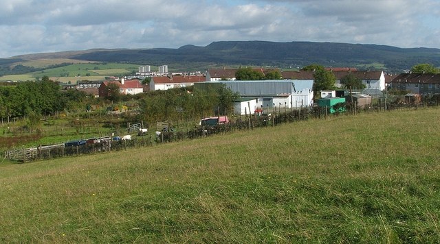
Image: © Lairich Rig Taken: 16 Sep 2009
See Image The larger animal enclosures can be seen here in front of the main cluster of buildings. The houses just behind the farm buildings are in the Castlehill area of Dumbarton, while the distant tower blocks, which would later be demolished, are in Bellsmyre: Image
Images are licensed for reuse under creativecommons.org/licenses/by-sa/2.0
Image Location
Latitude
55.951782
Longitude
-4.592411