Leicester Street and postbox
Introduction
The photograph on this page of Leicester Street and postbox by Robin Stott as part of the Geograph project.
The Geograph project started in 2005 with the aim of publishing, organising and preserving representative images for every square kilometre of Great Britain, Ireland and the Isle of Man.

There are currently over 7.5m images from over 14,400 individuals and you can help contribute to the project by visiting https://www.geograph.org.uk
Leicester Street and postbox
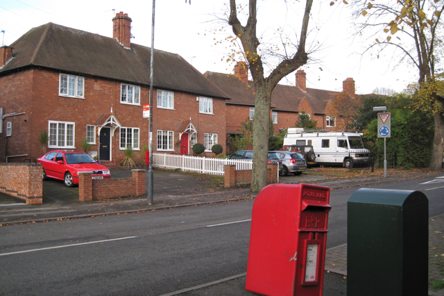
Image: © Robin Stott Taken: 27 Oct 2009
After the First World War "servicemen returned to the town to find that, despite a government promise, there were not enough houses and many had to live in condemned slums which often accommodated more people than when first built." Housing Acts were passed to enable a housing programme to be set up … "Leamington's first council houses were built using space standards and layout which are quite generous by present-day criteria. They were used as examples in the Housing Commissioners' Design Manual and were repeated almost exactly in later manuals until after the Second World War." These are some of those first council houses on the north side of Leicester Street, completed 1921-2. The postbox ID is CV32 69. Quotes from Lyndon Cave: Royal Leamington Spa, a history: 2009.
Images are licensed for reuse under creativecommons.org/licenses/by-sa/2.0
Image Location
Latitude
52.293881
Longitude
-1.526361