French influence in Hamilton produces difficult name, Chatelherault
Introduction
The photograph on this page of French influence in Hamilton produces difficult name, Chatelherault by A-M-Jervis as part of the Geograph project.
The Geograph project started in 2005 with the aim of publishing, organising and preserving representative images for every square kilometre of Great Britain, Ireland and the Isle of Man.

There are currently over 7.5m images from over 14,400 individuals and you can help contribute to the project by visiting https://www.geograph.org.uk
French influence in Hamilton produces difficult name, Chatelherault
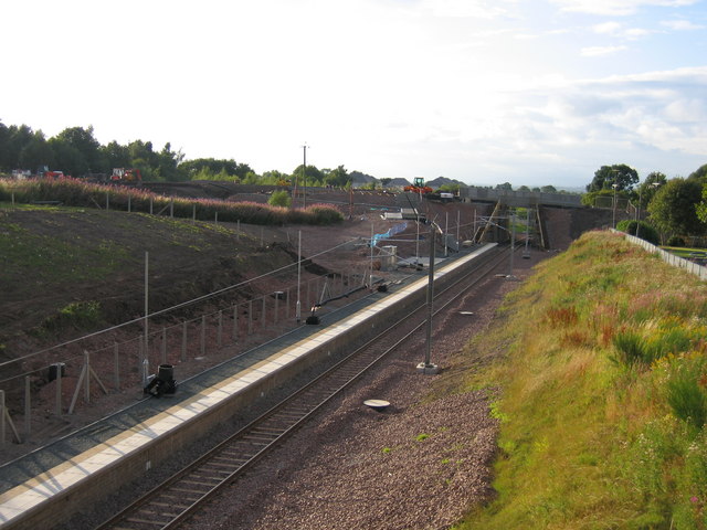
Image: © A-M-Jervis Taken: 13 Aug 2005
Once upon a time there was a railway station just north of here called Ferniegair, after a small village on the A72 road. It was moved slightly south in 1876 so that it could be served by trains from the Larkhall direction towards both Hamilton and Motherwell. It was one of numerous stations closed as a wartime economy in 1917 but, unlike most others temporarily closed in the same period, it never re-opened, though passenger trains continued to pass by until 1965. When the Larkhall was line was re-opened in 2005 it was decided to locate a station here but instead of calling it Allanton after the nearest village it was given the almost unpronounceable name of Chatelherault after the country park west of the A72. Here the station is under construction. The photograph is taken from Clyde Avenue bridge shortly before its demolition and replacement by the new Allanton approach road and bridge seen in the background.
Images are licensed for reuse under creativecommons.org/licenses/by-sa/2.0
Image Location
Latitude
55.765307
Longitude
-4.004679