Woodstock House, 1971
Introduction
The photograph on this page of Woodstock House, 1971 by John Baker as part of the Geograph project.
The Geograph project started in 2005 with the aim of publishing, organising and preserving representative images for every square kilometre of Great Britain, Ireland and the Isle of Man.

There are currently over 7.5m images from over 14,400 individuals and you can help contribute to the project by visiting https://www.geograph.org.uk
Woodstock House, 1971
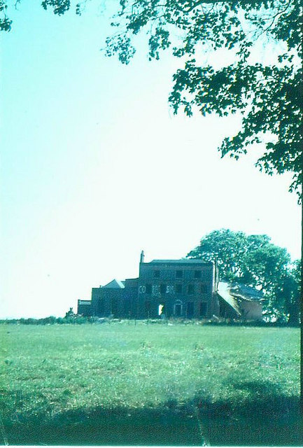
Image: © John Baker Taken: Unknown
Woodstock House was built in the early 1780s by Abraham Chambers. It was requisitioned by the Government during both world wars. Shortly after the estate became Shell property in 1945, land to the north of Broad Oak Road, and with it Woodstock House, was requisitioned by the Kent Farm Institute. For some time the building was used by Kent Fire Brigade as a practice site. Not surprisingly it became structurally unsound. Soon after this picture was taken, it was demolished.
Images are licensed for reuse under creativecommons.org/licenses/by-sa/2.0
Image Location
Latitude
51.31496
Longitude
0.727996