Buildings on Greenhill, Sherborne
Introduction
The photograph on this page of Buildings on Greenhill, Sherborne by Derek Harper as part of the Geograph project.
The Geograph project started in 2005 with the aim of publishing, organising and preserving representative images for every square kilometre of Great Britain, Ireland and the Isle of Man.

There are currently over 7.5m images from over 14,400 individuals and you can help contribute to the project by visiting https://www.geograph.org.uk
Buildings on Greenhill, Sherborne
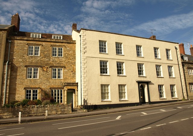
Image: © Derek Harper Taken: 23 Oct 2009
These buildings face The Green across the A30 at the top of the town centre. On the left is Abbot's Fee: " Probably early to rid (=mid) C19 front. 3 storey 2 window stone front. Tudor casements with label moulds, probably early to mid C19. Projecting porch of similar date with shafted supports. The front incorporates three carved stone quatrefoil panels, those at the ends being partially covered, one to left hand by a buttress, the other by the return wall of the next house. This suggests that part of the masonry is genuine medieval origin, possibly from Abbot Ramsam's New Inn, demolished circa 1842" http://www.imagesofengland.org.uk/Details/Default.aspx?id=103969&mode=adv , a description which is hard to trace as it is spelt "Abbotts Fee". On the right is Ramsam House, "Late C18 to early to mid C19. 3-storey, 5 window front, recently roughcast. Chamfered stone quoins. Moulded coping to parapet. Stringcourse. Stone plinth. Sash windows. Good late Georegian doorcase with fluted Tuscan pilasters and entablature; panelled spandrels; fanlight; flush panelled door with top 4 panels cut away and glazed". http://www.imagesofengland.org.uk/Details/Default.aspx?id=103968&mode=adv
Images are licensed for reuse under creativecommons.org/licenses/by-sa/2.0
Image Location
Latitude
50.950561
Longitude
-2.51827