Tip top view of Highbury Vale
Introduction
The photograph on this page of Tip top view of Highbury Vale by Alan Murray-Rust as part of the Geograph project.
The Geograph project started in 2005 with the aim of publishing, organising and preserving representative images for every square kilometre of Great Britain, Ireland and the Isle of Man.

There are currently over 7.5m images from over 14,400 individuals and you can help contribute to the project by visiting https://www.geograph.org.uk
Tip top view of Highbury Vale
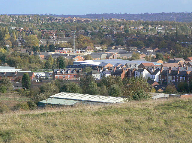
Image: © Alan Murray-Rust Taken: 25 Oct 2009
View from the top of the former Babbington Colliery spoil tip. The nearest housing is along Cinderhill Road. The tower crane stands in the grounds of Highbury Hospital. To the left of the crane is the façade of Bulwell Academy, formerly the Henry Mellish School. The distant skyline is the Mapperley ridge.
Images are licensed for reuse under creativecommons.org/licenses/by-sa/2.0
Image Location
Latitude
52.992074
Longitude
-1.199352