St. Michael's Church of Jesus Christ
Introduction
The photograph on this page of St. Michael's Church of Jesus Christ by Martin Addison as part of the Geograph project.
The Geograph project started in 2005 with the aim of publishing, organising and preserving representative images for every square kilometre of Great Britain, Ireland and the Isle of Man.

There are currently over 7.5m images from over 14,400 individuals and you can help contribute to the project by visiting https://www.geograph.org.uk
St. Michael's Church of Jesus Christ
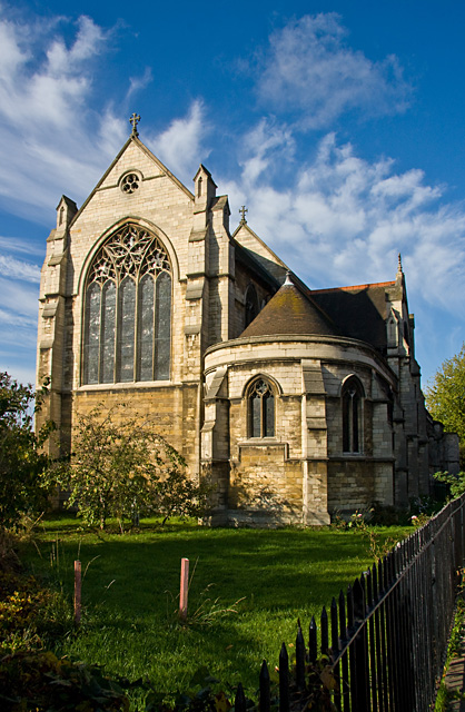
Image: © Martin Addison Taken: 23 Oct 2009
Originally church of england built circa 1910. It sits in a triangle between Mora Road, from which this photo is taken, St. Michael's Road and a strip of land that I believe belongs to the water company and carries a main pipe from the adjacent Cricklewood pumping station. Currently this is an Apostolic church.
Images are licensed for reuse under creativecommons.org/licenses/by-sa/2.0
Image Location
Latitude
51.558639
Longitude
-0.225076