2009 : The Griffin, Bridgeyate
Introduction
The photograph on this page of 2009 : The Griffin, Bridgeyate by Maurice Pullin as part of the Geograph project.
The Geograph project started in 2005 with the aim of publishing, organising and preserving representative images for every square kilometre of Great Britain, Ireland and the Isle of Man.

There are currently over 7.5m images from over 14,400 individuals and you can help contribute to the project by visiting https://www.geograph.org.uk
2009 : The Griffin, Bridgeyate
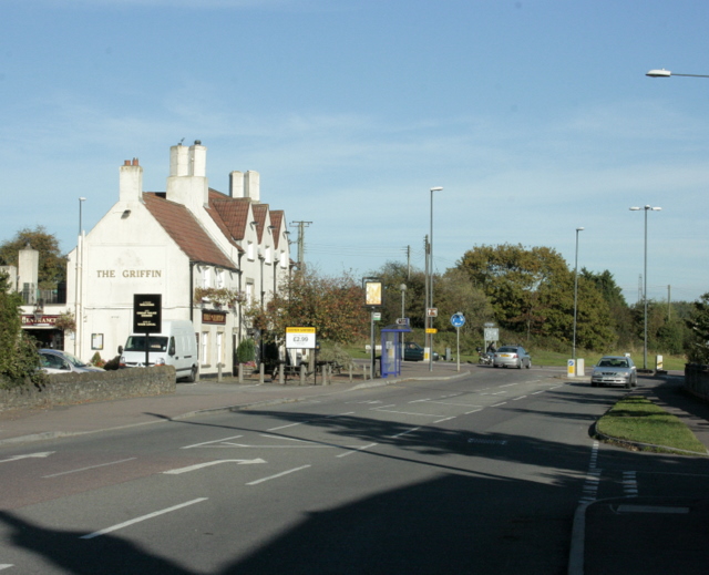
Image: © Maurice Pullin Taken: 12 Oct 2009
A420 passes the door. The road to the right at the roundabout is the A4175 heading south to Bitton and Keynsham. A minor road leaves to the left for Webb's Heath and Siston. The A420 continues to Chippenham. "Large, busy, 17th century inn which was refuge from the notorious 'Cocks Road Gang' of Highwaymen. Food served all day. Family beer garden. Live music on Friday and Sunday." The above was copied from:http://www.cauchy.demon.co.uk/raig/guide/BRIDGEYA.HTM look out for those highwaymen.
Images are licensed for reuse under creativecommons.org/licenses/by-sa/2.0
Image Location
Latitude
51.458122
Longitude
-2.462974