St Albans Abbey Station
Introduction
The photograph on this page of St Albans Abbey Station by Stephen McKay as part of the Geograph project.
The Geograph project started in 2005 with the aim of publishing, organising and preserving representative images for every square kilometre of Great Britain, Ireland and the Isle of Man.

There are currently over 7.5m images from over 14,400 individuals and you can help contribute to the project by visiting https://www.geograph.org.uk
St Albans Abbey Station
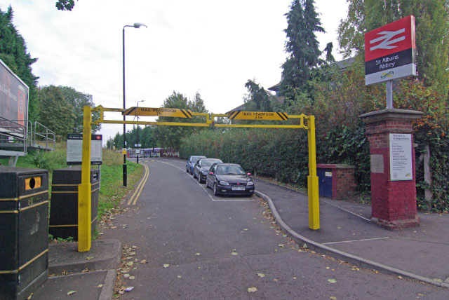
Image: © Stephen McKay Taken: 19 Oct 2009
This is the entrance at the foot of Holywell Hill to what is definitely St Albans' 'other' (albeit oldest) station - a stiffish uphill walk to the city centre. Trains run from here to Watford Junction - a list of the stations served directly is on the gatepost to the right of the entrance. Until 1951 there was also an infrequent service to Hatfield.
Images are licensed for reuse under creativecommons.org/licenses/by-sa/2.0
Image Location
Latitude
51.745061
Longitude
-0.342933