Borehamwood: Midland mainline railway
Introduction
The photograph on this page of Borehamwood: Midland mainline railway by Nigel Cox as part of the Geograph project.
The Geograph project started in 2005 with the aim of publishing, organising and preserving representative images for every square kilometre of Great Britain, Ireland and the Isle of Man.

There are currently over 7.5m images from over 14,400 individuals and you can help contribute to the project by visiting https://www.geograph.org.uk
Borehamwood: Midland mainline railway
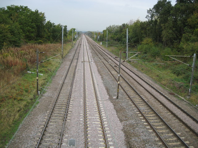
Image: © Nigel Cox Taken: 14 Oct 2009
This is another near repeat of one of Martin's images from 1979, this time Image, viewed from the Red Road bridge. The modern gantry seen in Martin's photo that was to carry the new electric signals which were replacing the old semaphore signals and were about to be commissioned in 1979 has long since itself disappeared from the scene. The up fast line has recently been re-ballasted. Just visible in the bottom of the photograph between the two fast lines, with a metal mesh cover over it, is a drainage catch pit. These pits have sumps that are designed to capture solid material that gets into the drainage system and will be periodically emptied. This photograph is taken from the bridge off Red Road, visible in another of Martin's images Image This is quite a massive structure the purpose of which is no longer clear. It was certainly present when the Ordnance Survey mapped the area in 1871, so it was quite probably part of the fabric of the original Midland Railway line. It has never carried a public road so maybe it was an accommodation bridge to allow the farmers at the former Tilehouse Farm to the east of the railway access to the fields to the west of it.
Images are licensed for reuse under creativecommons.org/licenses/by-sa/2.0
Image Location
Latitude
51.65919
Longitude
-0.28679