1GL Bench mark on Acton St Mary's church tower?
Introduction
The photograph on this page of 1GL Bench mark on Acton St Mary's church tower? by John S Turner as part of the Geograph project.
The Geograph project started in 2005 with the aim of publishing, organising and preserving representative images for every square kilometre of Great Britain, Ireland and the Isle of Man.

There are currently over 7.5m images from over 14,400 individuals and you can help contribute to the project by visiting https://www.geograph.org.uk
1GL Bench mark on Acton St Mary's church tower?
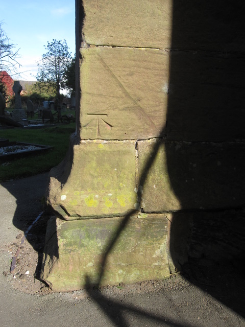
Image: © John S Turner Taken: 16 Oct 2009
This bench mark is on the south west face of the buttress at the north west corner of St Mary's church. The Grade I listing of the church http://www.imagesofengland.org.uk/details/default.aspx?id=56928 indicates that the tower dates to the 13th century and, although it collapsed and was rebuilt around 1757, the lower part is still original. However, like most old churches maintenance and changes are constantly taking place. The surveyors schedule from the Ordnance Survey's First Geodetic Levelling 1851-1858 on the line between Newcastle under Lyme and Chester, states that the CM is on the 'South-west angle of Acton Church tower'. This mark is on the north west angle of the church, albeit facing south west, so it now seems unlikely that this bench mark could be the one from the first survey. See also Image
Images are licensed for reuse under creativecommons.org/licenses/by-sa/2.0
Image Location
Latitude
53.073761
Longitude
-2.551471