Jarrow Road. Rotherhithe, London, SE16
Introduction
The photograph on this page of Jarrow Road. Rotherhithe, London, SE16 by Chris Lordan as part of the Geograph project.
The Geograph project started in 2005 with the aim of publishing, organising and preserving representative images for every square kilometre of Great Britain, Ireland and the Isle of Man.

There are currently over 7.5m images from over 14,400 individuals and you can help contribute to the project by visiting https://www.geograph.org.uk
Jarrow Road. Rotherhithe, London, SE16
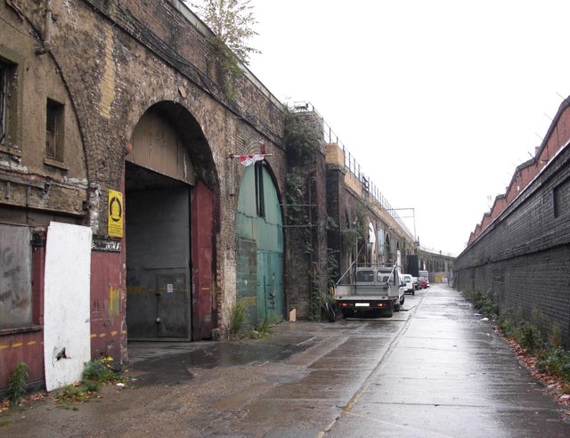
Image: © Chris Lordan Taken: 21 Oct 2009
Off Rotherhithe New Road and about 50 yards west of Corbetts Passage. In the 1960's to 1980's and long before that, it was only known by locals as "Bogs Ole". It consisted totally of businesses within railway arches that then connected Rotherhithe New Road to Silwood Street. At least two arches contained nothing other than bones - imagine the smell! The arch far left was the Halfway House pub. The arches were and are, part of the 878 built 1832ish to carry rail lines from London to Greenwich.
Images are licensed for reuse under creativecommons.org/licenses/by-sa/2.0
Image Location
Latitude
51.489241
Longitude
-0.056359