2009 : Syston Way, Hopewell Hill
Introduction
The photograph on this page of 2009 : Syston Way, Hopewell Hill by Maurice Pullin as part of the Geograph project.
The Geograph project started in 2005 with the aim of publishing, organising and preserving representative images for every square kilometre of Great Britain, Ireland and the Isle of Man.

There are currently over 7.5m images from over 14,400 individuals and you can help contribute to the project by visiting https://www.geograph.org.uk
2009 : Syston Way, Hopewell Hill
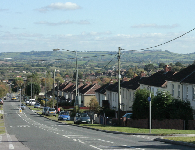
Image: © Maurice Pullin Taken: 12 Oct 2009
Heading east, a little further down it becomes Cheltenham Road leading into New Cheltenham, a housing estate mostly built in the 1950/60's. On the skyline to the right a line of trees marks Freezing Hill Image a prominent landmark in the area between Bath and Bristol. On the extreme right the horizon slopes up to Lansdown, which is not shown here.
Images are licensed for reuse under creativecommons.org/licenses/by-sa/2.0
Image Location
Latitude
51.467734
Longitude
-2.508419