Bench mark on Chatterton House
Introduction
The photograph on this page of Bench mark on Chatterton House by John S Turner as part of the Geograph project.
The Geograph project started in 2005 with the aim of publishing, organising and preserving representative images for every square kilometre of Great Britain, Ireland and the Isle of Man.

There are currently over 7.5m images from over 14,400 individuals and you can help contribute to the project by visiting https://www.geograph.org.uk
Bench mark on Chatterton House
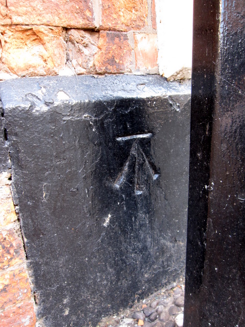
Image: © John S Turner Taken: 16 Oct 2009
This bench mark is on the corner of Church Lane and Hospital Street. It probably does not date to the First Geodetic Levelling survey 1851-1858, on the survey line between Newcastle under Lyme and Chester, as it was originally recorded as being on the corner of a house, and the height of this one above ground level is quite a bit higher than the early mark. The modern O.S database has it on the corner of the Lamb Hotel and records suggest that there has been a hotel on this site since the 16th century, and that this 'Lamb Hotel' was only built in 1861, which would be too late for the first survey. The building has now been redeveloped into apartments, shops, and a restaurant - Costa Coffee in 2009. The bench mark is behind the lamppost on the corner, and there is an interesting local website that records some of the recent changes to the building: http://www.dabbersnantwich.me.uk/the_lamb.htm
Images are licensed for reuse under creativecommons.org/licenses/by-sa/2.0
Image Location
Latitude
53.066257
Longitude
-2.52123