The back streets of Preston!
Introduction
The photograph on this page of The back streets of Preston! by Martin Stockdale as part of the Geograph project.
The Geograph project started in 2005 with the aim of publishing, organising and preserving representative images for every square kilometre of Great Britain, Ireland and the Isle of Man.

There are currently over 7.5m images from over 14,400 individuals and you can help contribute to the project by visiting https://www.geograph.org.uk
The back streets of Preston!
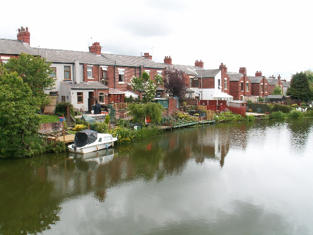
Image: © Martin Stockdale Taken: 5 Jun 2005
From the front, this is a typical row of terraced houses. From the back, however, the southern end of the Lancaster Canal provides a totally unexpected view. The Canal once ran right into the middle of Preston, terminating at Fishergate - the 1940's map clearly shows this. With the modern developments in the city, the canal now ends here.
Images are licensed for reuse under creativecommons.org/licenses/by-sa/2.0
Image Location


Leaflet Map data © OpenStreetMap
Latitude
53.768666
Longitude
-2.722118