North-western extremity of New Thundersley
Introduction
The photograph on this page of North-western extremity of New Thundersley by Edward Clack as part of the Geograph project.
The Geograph project started in 2005 with the aim of publishing, organising and preserving representative images for every square kilometre of Great Britain, Ireland and the Isle of Man.

There are currently over 7.5m images from over 14,400 individuals and you can help contribute to the project by visiting https://www.geograph.org.uk
North-western extremity of New Thundersley
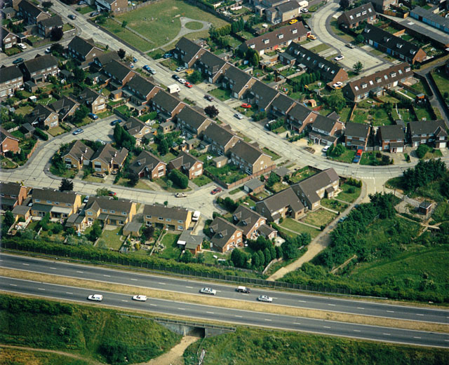
Image: © Edward Clack Taken: 13 Jun 1988
The road across the bottom is the A130, from Canvey Island to the roundabout on the A127 trunk road. Above this road is the top left-hand corner of New Thundersley. The tunnel below the road leads from the built-up area into the more rural areas of Bowers Gifford.
Images are licensed for reuse under creativecommons.org/licenses/by-sa/2.0
Image Location
Latitude
51.576912
Longitude
0.549812