Highbury Fields
Introduction
The photograph on this page of Highbury Fields by Stephen McKay as part of the Geograph project.
The Geograph project started in 2005 with the aim of publishing, organising and preserving representative images for every square kilometre of Great Britain, Ireland and the Isle of Man.

There are currently over 7.5m images from over 14,400 individuals and you can help contribute to the project by visiting https://www.geograph.org.uk
Highbury Fields
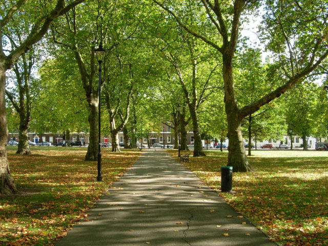
Image: © Stephen McKay Taken: 12 Oct 2009
Highbury Fields dates back as a public park to 1885. This is the view along Queen's Walk which leads across from Highbury Crescent to Highbury Place.
Images are licensed for reuse under creativecommons.org/licenses/by-sa/2.0
Image Location
Latitude
51.548721
Longitude
-0.10272