Mile End Park by the Regent's Canal
Introduction
The photograph on this page of Mile End Park by the Regent's Canal by Natasha Ceridwen de Chroustchoff as part of the Geograph project.
The Geograph project started in 2005 with the aim of publishing, organising and preserving representative images for every square kilometre of Great Britain, Ireland and the Isle of Man.

There are currently over 7.5m images from over 14,400 individuals and you can help contribute to the project by visiting https://www.geograph.org.uk
Mile End Park by the Regent's Canal
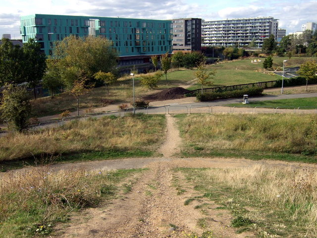
Image: © Natasha Ceridwen de Chroustchoff Taken: 4 Oct 2009
View northwest from the hillock at the southern end of what is now Mile End Park. In past times there was a reservoir here, next, public pleasure gardens attached to the New Globe Tavern, then the land was used for housing before its resurrection as a public open space. The hill provides excellent views of the surrounding area. A circular access path is crossed by this more direct route.
Images are licensed for reuse under creativecommons.org/licenses/by-sa/2.0
Image Location
Latitude
51.526469
Longitude
-0.040069