Cliff erosion north of Salterfen Rocks
Introduction
The photograph on this page of Cliff erosion north of Salterfen Rocks by Andrew Curtis as part of the Geograph project.
The Geograph project started in 2005 with the aim of publishing, organising and preserving representative images for every square kilometre of Great Britain, Ireland and the Isle of Man.

There are currently over 7.5m images from over 14,400 individuals and you can help contribute to the project by visiting https://www.geograph.org.uk
Cliff erosion north of Salterfen Rocks
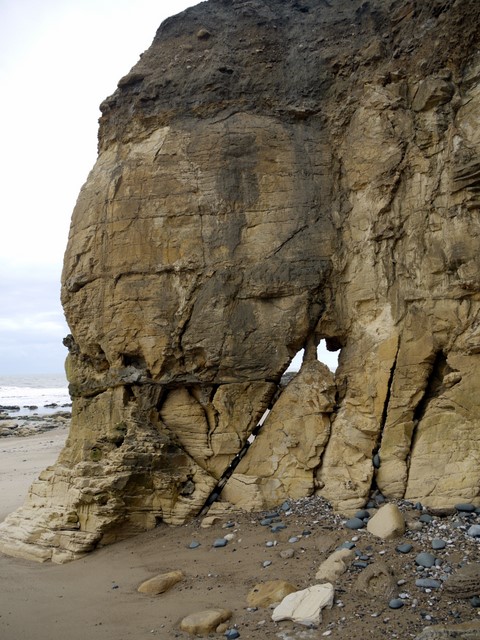
Image: © Andrew Curtis Taken: 9 Oct 2009
Faults in the magnesian limestone cliffs on the Durham coast are exploited by the sea leading to caves, stacks and arches. This coastline is rapidly eroding and there are frequent rock falls and slippage of the unstable capping layer of boulder clay clearly visible in this photograph.
Images are licensed for reuse under creativecommons.org/licenses/by-sa/2.0
Image Location
Latitude
54.88238
Longitude
-1.356703