The Antonine Wall at Dullatur
Introduction
The photograph on this page of The Antonine Wall at Dullatur by Robert Murray as part of the Geograph project.
The Geograph project started in 2005 with the aim of publishing, organising and preserving representative images for every square kilometre of Great Britain, Ireland and the Isle of Man.

There are currently over 7.5m images from over 14,400 individuals and you can help contribute to the project by visiting https://www.geograph.org.uk
The Antonine Wall at Dullatur
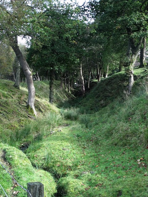
Image: © Robert Murray Taken: 6 Oct 2009
The ditch and rampart to be more precise. Described on the 1922 edition of the O.S. plan as "Remains of the wall of Antoninus Pius constructed by Lollius Urbicus A.D. 140 Roman Legions II VI & XX."
Images are licensed for reuse under creativecommons.org/licenses/by-sa/2.0
Image Location
Latitude
55.972126
Longitude
-3.997257