Pondhead Spinney
Introduction
The photograph on this page of Pondhead Spinney by Kokai as part of the Geograph project.
The Geograph project started in 2005 with the aim of publishing, organising and preserving representative images for every square kilometre of Great Britain, Ireland and the Isle of Man.

There are currently over 7.5m images from over 14,400 individuals and you can help contribute to the project by visiting https://www.geograph.org.uk
Pondhead Spinney
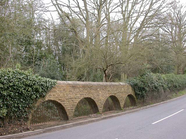
Image: © Kokai Taken: 12 Apr 2006
At this lowest point in the road leading north-west from east Northampton to Moulton, the open brickwork construction would allow any flooding from the large pond behind the spinney to turn the road into a ford.
Images are licensed for reuse under creativecommons.org/licenses/by-sa/2.0
Image Location
Latitude
52.280019
Longitude
-0.827316