South Otterington
Introduction
The photograph on this page of South Otterington by Mick Garratt as part of the Geograph project.
The Geograph project started in 2005 with the aim of publishing, organising and preserving representative images for every square kilometre of Great Britain, Ireland and the Isle of Man.

There are currently over 7.5m images from over 14,400 individuals and you can help contribute to the project by visiting https://www.geograph.org.uk
South Otterington
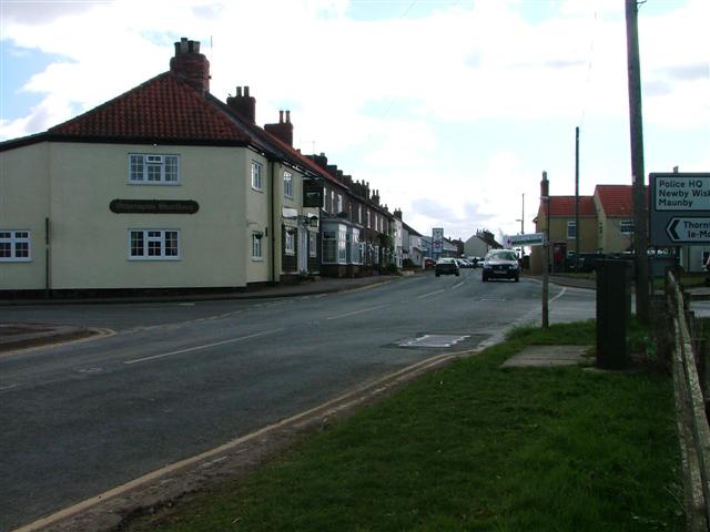
Image: © Mick Garratt Taken: 14 Apr 2006
The main street (A167) through the village. On the left is the village pub, The Otterington Shorthorn. The building is early 19c but the name must date to the 18c when advances in breeding techniques produced bigger cattle than the traditional breeds. The biggest bulls became very famous and very valuable.
Images are licensed for reuse under creativecommons.org/licenses/by-sa/2.0
Image Location
Latitude
54.281783
Longitude
-1.428604