Congregational hall and school, Wiveliscombe
Introduction
The photograph on this page of Congregational hall and school, Wiveliscombe by Derek Harper as part of the Geograph project.
The Geograph project started in 2005 with the aim of publishing, organising and preserving representative images for every square kilometre of Great Britain, Ireland and the Isle of Man.

There are currently over 7.5m images from over 14,400 individuals and you can help contribute to the project by visiting https://www.geograph.org.uk
Congregational hall and school, Wiveliscombe
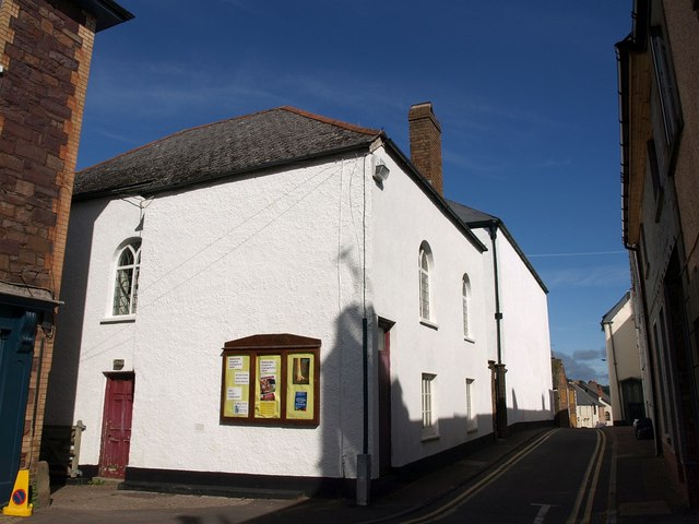
Image: © Derek Harper Taken: 29 Sep 2009
Jutting out into Silver Street, this building forms a pair with the Congregational church beyond; the two entrances face each other across a small yard. This building dates from 1825 http://webapp1.somerset.gov.uk/her/details.asp?prn=45083 . On the right, Silver Street continues into Golden Hill.
Images are licensed for reuse under creativecommons.org/licenses/by-sa/2.0
Image Location
Latitude
51.042729
Longitude
-3.311251