Limekiln on Grin Low
Introduction
The photograph on this page of Limekiln on Grin Low by Alan Murray-Rust as part of the Geograph project.
The Geograph project started in 2005 with the aim of publishing, organising and preserving representative images for every square kilometre of Great Britain, Ireland and the Isle of Man.

There are currently over 7.5m images from over 14,400 individuals and you can help contribute to the project by visiting https://www.geograph.org.uk
Limekiln on Grin Low
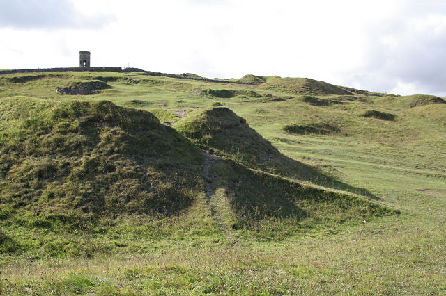
Image: © Alan Murray-Rust Taken: 1 Oct 2009
This is the downhill side of the kiln shown in http://www.geograph.org.uk/photo/1518952 . On this side there would probably have been a stone facing with a drawhole for extracting the burnt limestone at the bottom. In the background can be seen Solomon's Temple on the top of Grin Low.
Images are licensed for reuse under creativecommons.org/licenses/by-sa/2.0
Image Location
Latitude
53.244185
Longitude
-1.91994