"Fire"
Introduction
The photograph on this page of "Fire" by David Clark as part of the Geograph project.
The Geograph project started in 2005 with the aim of publishing, organising and preserving representative images for every square kilometre of Great Britain, Ireland and the Isle of Man.

There are currently over 7.5m images from over 14,400 individuals and you can help contribute to the project by visiting https://www.geograph.org.uk
"Fire"
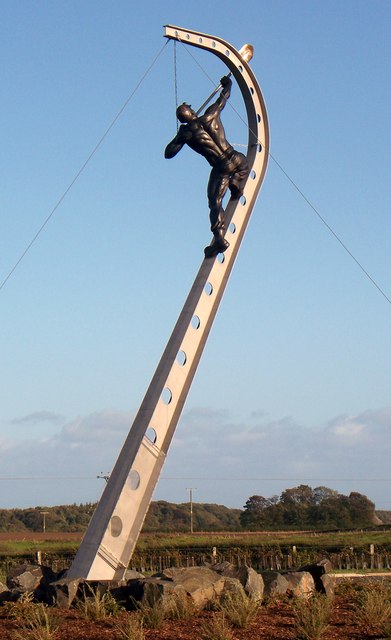
Image: © David Clark Taken: 3 Oct 2009
Locally known as Robin of Pegswood. Erected on a 'boring' roundabout on the Pegswood bypass. More about Robin can be found via this link and elsewhere. http://www.morpethherald.co.uk/news/Meet-Robin-of-Pegswood.5634658.jp
Images are licensed for reuse under creativecommons.org/licenses/by-sa/2.0
Image Location
Latitude
55.17632
Longitude
-1.640571