Harwich Parkeston Quay Station
Introduction
The photograph on this page of Harwich Parkeston Quay Station by Martin Addison as part of the Geograph project.
The Geograph project started in 2005 with the aim of publishing, organising and preserving representative images for every square kilometre of Great Britain, Ireland and the Isle of Man.

There are currently over 7.5m images from over 14,400 individuals and you can help contribute to the project by visiting https://www.geograph.org.uk
Harwich Parkeston Quay Station
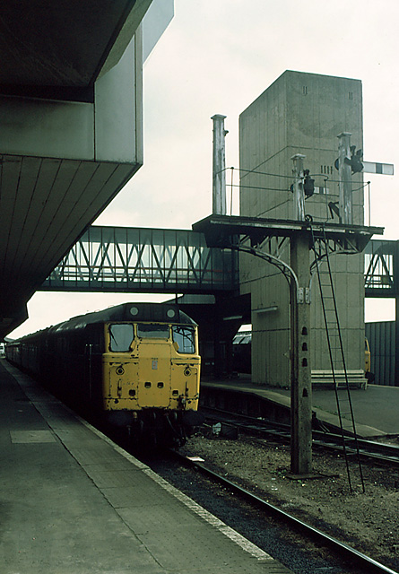
Image: © Martin Addison Taken: Unknown
Or Harwich International as it is now known. This photograph from 1984 pre-dates the electrification of the branch. Note the concrete posted LNER semaphore signals still in location but out of use. Services to the station at this time were a mixture of loco hauled boat trains from London and Manchester and 2 car dmu services from Manningtree that terminated at Harwich Town, at the end of the branch.
Images are licensed for reuse under creativecommons.org/licenses/by-sa/2.0
Image Location
Latitude
51.947408
Longitude
1.254362