All Saints church, Thurlestone
Introduction
The photograph on this page of All Saints church, Thurlestone by Derek Harper as part of the Geograph project.
The Geograph project started in 2005 with the aim of publishing, organising and preserving representative images for every square kilometre of Great Britain, Ireland and the Isle of Man.

There are currently over 7.5m images from over 14,400 individuals and you can help contribute to the project by visiting https://www.geograph.org.uk
All Saints church, Thurlestone
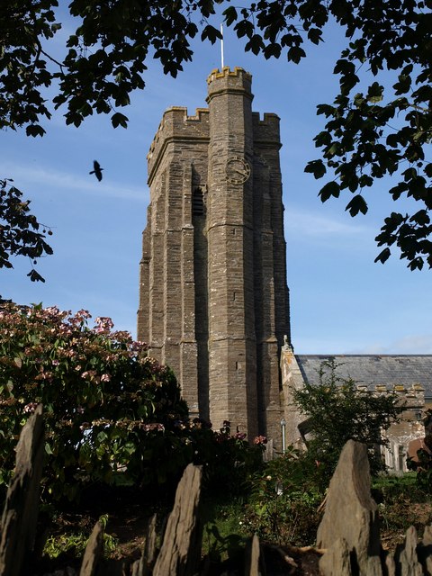
Image: © Derek Harper Taken: 24 Sep 2009
A rook flies to the tower of Image The tower, like much of the church, is C15, but some of the building is C13. http://www.imagesofengland.org.uk/Details/Default.aspx?id=100859&mode=adv Seen from Eddystone Road, with the jagged slates of the churchyard wall in the foreground.
Images are licensed for reuse under creativecommons.org/licenses/by-sa/2.0
Image Location


Leaflet Map data © OpenStreetMap
Latitude
50.270853
Longitude
-3.863314