Ollerton Pit Woods - Main Entrance
Introduction
The photograph on this page of Ollerton Pit Woods - Main Entrance by Alan Heardman as part of the Geograph project.
The Geograph project started in 2005 with the aim of publishing, organising and preserving representative images for every square kilometre of Great Britain, Ireland and the Isle of Man.

There are currently over 7.5m images from over 14,400 individuals and you can help contribute to the project by visiting https://www.geograph.org.uk
Ollerton Pit Woods - Main Entrance
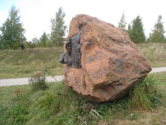
Image: © Alan Heardman Taken: 29 Sep 2009
Situated near the main car park, this plaque celebrates the restoration of 14 colliery spoil heaps and 8 former collieries. A total of 829 hectares (2050 acres) restored to woodland and open space between 1996 and 2000. These woodlands are a gift to the people of Nottinghamshire in commemoration of the areas mining heritage.
Images are licensed for reuse under creativecommons.org/licenses/by-sa/2.0
Image Location
Latitude
53.199743
Longitude
-0.99938