View down Bold Street from The Mount Gardens
Introduction
The photograph on this page of View down Bold Street from The Mount Gardens by Paul Harris as part of the Geograph project.
The Geograph project started in 2005 with the aim of publishing, organising and preserving representative images for every square kilometre of Great Britain, Ireland and the Isle of Man.

There are currently over 7.5m images from over 14,400 individuals and you can help contribute to the project by visiting https://www.geograph.org.uk
View down Bold Street from The Mount Gardens
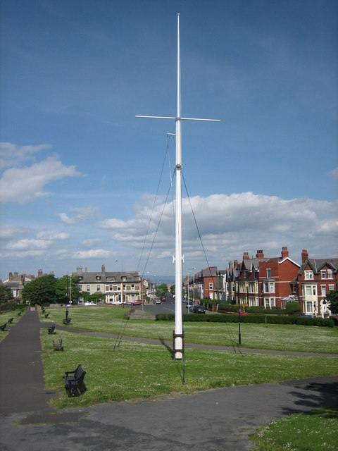
Image: © Paul Harris Taken: 3 Jun 2009
Bold Street is one of numerous roads that radiate out in a spoke-like pattern from The Mount as part of the original town-plan envisaged by Sir Peter Hesketh-Fleetwood, the town's founder. Bold Street leads towards the River Wyre estuary, overlooking Morecambe Bay and the Bowland Fells, both of which are visible in the background. The ornamental ship mast and greenery form a part of The Mount Gardens, which contains the highest piece of land in Fleetwood and has The Mount http://www.geograph.org.uk/photo/1467972 as its centrepiece.
Images are licensed for reuse under creativecommons.org/licenses/by-sa/2.0
Image Location
Latitude
53.92581
Longitude
-3.015696