Bull's Head, Pratt's Bottom
Introduction
The photograph on this page of Bull's Head, Pratt's Bottom by Roger W Haworth as part of the Geograph project.
The Geograph project started in 2005 with the aim of publishing, organising and preserving representative images for every square kilometre of Great Britain, Ireland and the Isle of Man.

There are currently over 7.5m images from over 14,400 individuals and you can help contribute to the project by visiting https://www.geograph.org.uk
Bull's Head, Pratt's Bottom
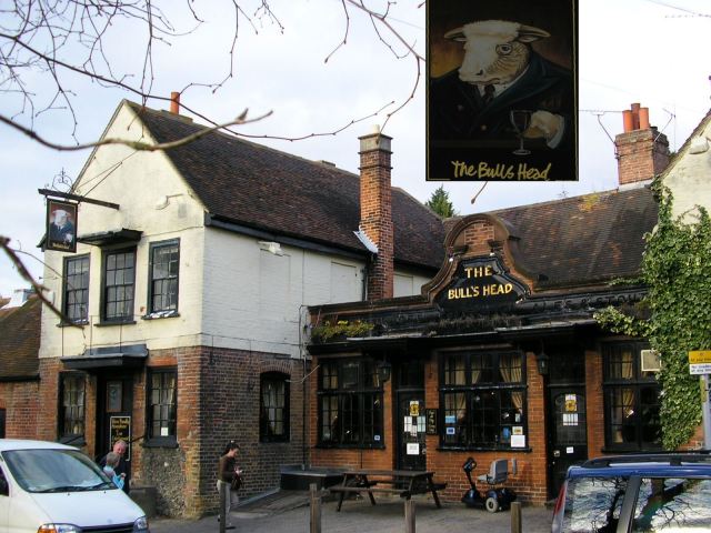
Image: © Roger W Haworth Taken: 29 Mar 2006
This pub beside the village green is the original centre of the village, not the roundabout on Sevenoaks Road which is 500 metres further north. Of course the pub sign is not meant to look Patrick Moore, astronomer he wears his monocle in the other eye!
Images are licensed for reuse under creativecommons.org/licenses/by-sa/2.0
Image Location
Latitude
51.339836
Longitude
0.111906