Redriff Estate (part), Rotherhithe, London, SE16
Introduction
The photograph on this page of Redriff Estate (part), Rotherhithe, London, SE16 by Chris Lordan as part of the Geograph project.
The Geograph project started in 2005 with the aim of publishing, organising and preserving representative images for every square kilometre of Great Britain, Ireland and the Isle of Man.

There are currently over 7.5m images from over 14,400 individuals and you can help contribute to the project by visiting https://www.geograph.org.uk
Redriff Estate (part), Rotherhithe, London, SE16
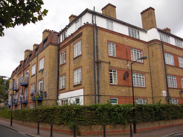
Image: © Chris Lordan Taken: 23 Sep 2009
There are eight other blocks of varying sizes that complete the estate that is bounded by Rotherhithe Street, Elgar Street (Late York Street), Gulliver Street and Odessa Street (late Thames Street). Before the estate was built there was a Derrick Street (late Russel Street) between Elgar and Odessa Streets (about right of the image). Russel Street was named for the connection with the Duke of Bedfords family. Estate built 1931/40 as a community estate and comprised of a hall, gym, kitchen and hobby room with external facilities for football and cricket. Dignitaries from all over the UK attended the opening.
Images are licensed for reuse under creativecommons.org/licenses/by-sa/2.0
Image Location
Latitude
51.497423
Longitude
-0.034688