Marehill: Former Providence Chapel
Introduction
The photograph on this page of Marehill: Former Providence Chapel by Nigel Cox as part of the Geograph project.
The Geograph project started in 2005 with the aim of publishing, organising and preserving representative images for every square kilometre of Great Britain, Ireland and the Isle of Man.

There are currently over 7.5m images from over 14,400 individuals and you can help contribute to the project by visiting https://www.geograph.org.uk
Marehill: Former Providence Chapel
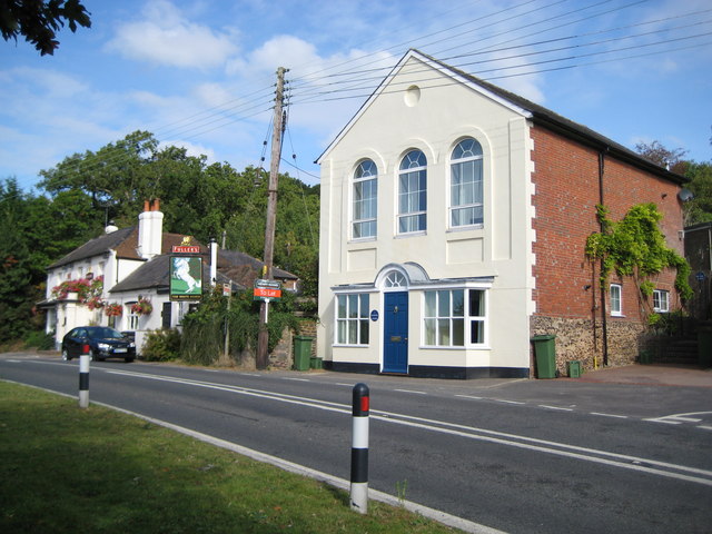
Image: © Nigel Cox Taken: 17 Sep 2009
The Chapel may have been built around 1845, but is certainly present on the 1880 Ordnance Survey map and described then as a Congregationalist place of worship. At the time the photograph was taken the building, which appears to be in excellent order, was to let. Fullers' White Horse public house is to the left, qualifying the photo in the "Saints and Sinners" category. The road is the A283 looking towards Pulborough.
Images are licensed for reuse under creativecommons.org/licenses/by-sa/2.0
Image Location
Latitude
50.955402
Longitude
-0.486791