Thurgarton Priory
Introduction
The photograph on this page of Thurgarton Priory by Alan Murray-Rust as part of the Geograph project.
The Geograph project started in 2005 with the aim of publishing, organising and preserving representative images for every square kilometre of Great Britain, Ireland and the Isle of Man.

There are currently over 7.5m images from over 14,400 individuals and you can help contribute to the project by visiting https://www.geograph.org.uk
Thurgarton Priory
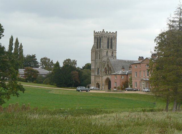
Image: © Alan Murray-Rust Taken: 24 Sep 2009
The church and the house. The nave roof is a 19th century alteration, and the lancets in the gable are of this period. Originally the nave would have been much higher, and there is evidence of this on the side of the tower. However, the main west door is original. This and the tower date from around 1230. The house dates from 1772 and takes the place of the original conventual buildings.
Images are licensed for reuse under creativecommons.org/licenses/by-sa/2.0
Image Location
Latitude
53.035075
Longitude
-0.96979