Cawsand - from Cawsand Beach
Introduction
The photograph on this page of Cawsand - from Cawsand Beach by Rob Farrow as part of the Geograph project.
The Geograph project started in 2005 with the aim of publishing, organising and preserving representative images for every square kilometre of Great Britain, Ireland and the Isle of Man.

There are currently over 7.5m images from over 14,400 individuals and you can help contribute to the project by visiting https://www.geograph.org.uk
Cawsand - from Cawsand Beach
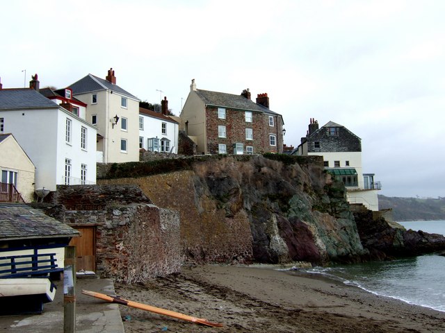
Image: © Rob Farrow Taken: 2 Apr 2006
The houses are on Garrett Street as it climbs from the Square in Cawsand. A passenger ferry runs in the summer from this beach to the Mayflower Steps in Plymouth across Plymouth Sound. The ferry trip takes half-an-hour or so and can be quite choppy.
Images are licensed for reuse under creativecommons.org/licenses/by-sa/2.0
Image Location
Latitude
50.330864
Longitude
-4.201627