West Chinnock
Introduction
The photograph on this page of West Chinnock by Derek Harper as part of the Geograph project.
The Geograph project started in 2005 with the aim of publishing, organising and preserving representative images for every square kilometre of Great Britain, Ireland and the Isle of Man.

There are currently over 7.5m images from over 14,400 individuals and you can help contribute to the project by visiting https://www.geograph.org.uk
West Chinnock
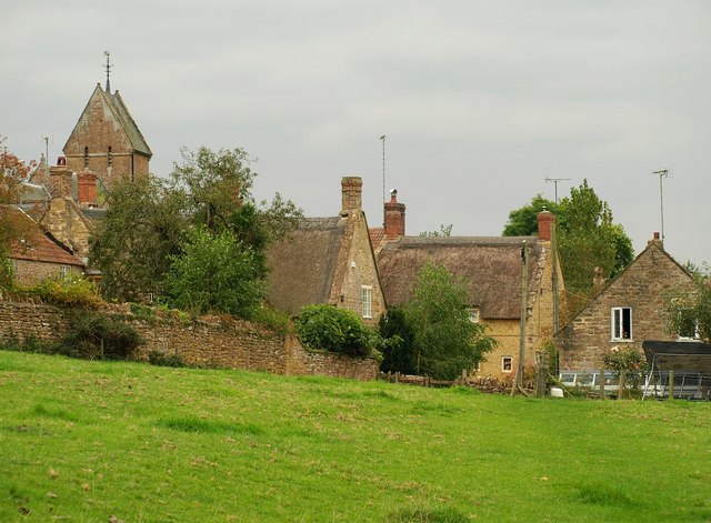
Image: © Derek Harper Taken: 15 Sep 2009
Approaching the village on the footpath mentioned in Image On the left is the saddleback tower of Image http://www.imagesofengland.org.uk/Details/Default.aspx?id=263763&mode=adv . The two C17 thatched cottages in the centre, Tree Cottage ( http://www.imagesofengland.org.uk/Details/Default.aspx?id=263782&mode=adv ) and the Old School House ( http://www.imagesofengland.org.uk/details/default.aspx?id=263779 ), are either side of Higher Street.
Images are licensed for reuse under creativecommons.org/licenses/by-sa/2.0
Image Location


Leaflet Map data © OpenStreetMap
Latitude
50.917587
Longitude
-2.759599