Old railway bridge, The Path
Introduction
The photograph on this page of Old railway bridge, The Path by Richard Webb as part of the Geograph project.
The Geograph project started in 2005 with the aim of publishing, organising and preserving representative images for every square kilometre of Great Britain, Ireland and the Isle of Man.

There are currently over 7.5m images from over 14,400 individuals and you can help contribute to the project by visiting https://www.geograph.org.uk
Old railway bridge, The Path
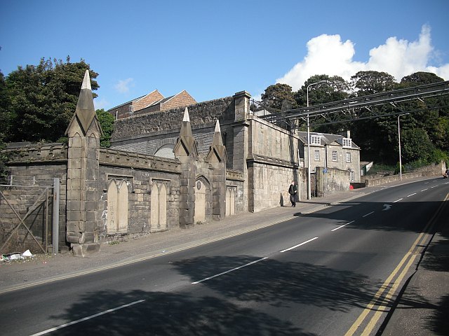
Image: © Richard Webb Taken: 20 Sep 2009
Buttress of a former railway bridge at the north end of Kirkcaldy's long High Street. The pipes crossing the road were making a sound a bit like augered grain, likely since it connects parts of a flour mill.
Images are licensed for reuse under creativecommons.org/licenses/by-sa/2.0
Image Location
Latitude
56.117713
Longitude
-3.15118