Butterworth Hall Brook
Introduction
The photograph on this page of Butterworth Hall Brook by Dr Neil Clifton as part of the Geograph project.
The Geograph project started in 2005 with the aim of publishing, organising and preserving representative images for every square kilometre of Great Britain, Ireland and the Isle of Man.

There are currently over 7.5m images from over 14,400 individuals and you can help contribute to the project by visiting https://www.geograph.org.uk
Butterworth Hall Brook
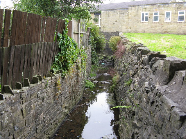
Image: © Dr Neil Clifton Taken: 18 Sep 2009
This tiny brook runs in front of the houses on Good Intent, and is seen here looking upstream (eastwards). Behind the photographer it continues, mainly culverted, until within a quarter of a mile it has joined the River Beal, whence its waters will travel via the Rivers Roch, Irwell and Mersey until they eventually reach the Irish Sea.
Images are licensed for reuse under creativecommons.org/licenses/by-sa/2.0
Image Location


Leaflet Map data © OpenStreetMap
Latitude
53.607213
Longitude
-2.104244