No 1, Good Intent, Milnrow
Introduction
The photograph on this page of No 1, Good Intent, Milnrow by Dr Neil Clifton as part of the Geograph project.
The Geograph project started in 2005 with the aim of publishing, organising and preserving representative images for every square kilometre of Great Britain, Ireland and the Isle of Man.

There are currently over 7.5m images from over 14,400 individuals and you can help contribute to the project by visiting https://www.geograph.org.uk
No 1, Good Intent, Milnrow
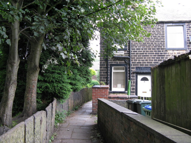
Image: © Dr Neil Clifton Taken: 18 Sep 2009
The houses on Good Intent back directly on to those in Charles Lane, so we have examples still in 2009 of occupied and cared-for back-to-back houses. The footpath in the photograph leads into Charles Lane.
Images are licensed for reuse under creativecommons.org/licenses/by-sa/2.0
Image Location
Latitude
53.607482
Longitude
-2.103942