Church of St Peter and St Paul, Godalming
Introduction
The photograph on this page of Church of St Peter and St Paul, Godalming by Humphrey Bolton as part of the Geograph project.
The Geograph project started in 2005 with the aim of publishing, organising and preserving representative images for every square kilometre of Great Britain, Ireland and the Isle of Man.

There are currently over 7.5m images from over 14,400 individuals and you can help contribute to the project by visiting https://www.geograph.org.uk
Church of St Peter and St Paul, Godalming
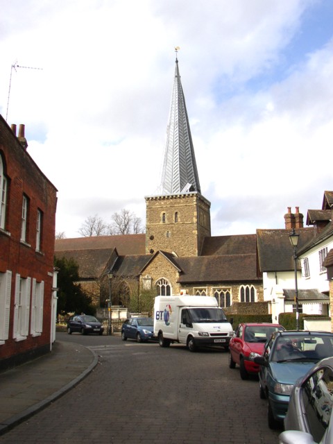
Image: © Humphrey Bolton Taken: 31 Mar 2006
There are fragments of Saxon work, and the Normans built the central tower, on which is a lead spire of (probably) the 13C. This has a number of shallow V-sections formed from lead plates. The range of buildings in front of the tower are the south aisle, transept and south chapel, all added in the 12C and 13C. The church was extensively restored in the 19C.
Images are licensed for reuse under creativecommons.org/licenses/by-sa/2.0
Image Location


Leaflet Map data © OpenStreetMap
Latitude
51.186141
Longitude
-0.616329