Bridport: postbox № DT6 38, St. Andrew?s Road
Introduction
The photograph on this page of Bridport: postbox № DT6 38, St. Andrew?s Road by Chris Downer as part of the Geograph project.
The Geograph project started in 2005 with the aim of publishing, organising and preserving representative images for every square kilometre of Great Britain, Ireland and the Isle of Man.

There are currently over 7.5m images from over 14,400 individuals and you can help contribute to the project by visiting https://www.geograph.org.uk
Bridport: postbox № DT6 38, St. Andrew?s Road
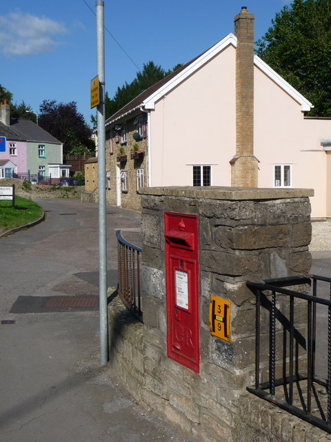
Image: © Chris Downer Taken: 12 Sep 2009
This George V-reign postbox is set into a wall on the main road to Beaminster. It is in the area known as St. Andrew's Well and the building in the distance, which looks like a former pub, is called The Well and is now a b&b. The box is emptied finally at 4:45pm on weekdays and at noon on Saturdays.
Images are licensed for reuse under creativecommons.org/licenses/by-sa/2.0
Image Location
Latitude
50.74161
Longitude
-2.744276