All Saints Church and monolith, Rudston, 1979
Introduction
The photograph on this page of All Saints Church and monolith, Rudston, 1979 by Harold Dilworth Crewdson as part of the Geograph project.
The Geograph project started in 2005 with the aim of publishing, organising and preserving representative images for every square kilometre of Great Britain, Ireland and the Isle of Man.

There are currently over 7.5m images from over 14,400 individuals and you can help contribute to the project by visiting https://www.geograph.org.uk
All Saints Church and monolith, Rudston, 1979
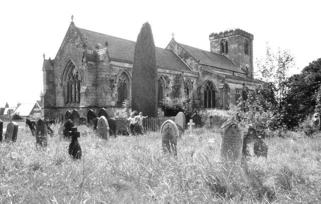
Image: © Harold Dilworth Crewdson Taken: Unknown
In this image the menhir is without the lead cap to protect it from the elements; it also has a picket fence surrounding it.
Images are licensed for reuse under creativecommons.org/licenses/by-sa/2.0
Image Location
Latitude
54.09352
Longitude
-0.324164