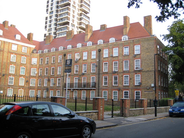
Camberwell: Cameron House, Comber Grove, SE5
Introduction
The photograph on this page of Camberwell: Cameron House, Comber Grove, SE5 by Nigel Cox as part of the Geograph project.
The Geograph project started in 2005 with the aim of publishing, organising and preserving representative images for every square kilometre of Great Britain, Ireland and the Isle of Man.
There are currently over 7.5m images from over 14,400 individuals and you can help contribute to the project by visiting https://www.geograph.org.uk

Image: © Nigel Cox Taken: 11 Sep 2009
This is one wing of a particularly fine U-shaped block of former London County Council flats, built between the wars in a style that has as its origin large town houses of the early eighteenth century Queen Anne period. As a later example of social housing behind can be seen one of the five tower blocks on the Wyndham Estate, this one being Coniston House. The road is Comber Grove, although from early Ordnance Survey maps, certainly up to 1938, it was Leipzig Road, the name presumably falling out of favour in the light of subsequent events.

