Camberwell: St John the Divine Primary School, SE5
Introduction
The photograph on this page of Camberwell: St John the Divine Primary School, SE5 by Nigel Cox as part of the Geograph project.
The Geograph project started in 2005 with the aim of publishing, organising and preserving representative images for every square kilometre of Great Britain, Ireland and the Isle of Man.

There are currently over 7.5m images from over 14,400 individuals and you can help contribute to the project by visiting https://www.geograph.org.uk
Camberwell: St John the Divine Primary School, SE5
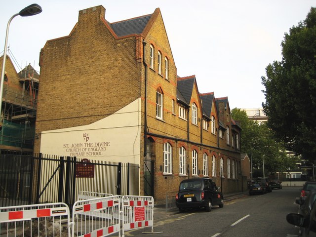
Image: © Nigel Cox Taken: 11 Sep 2009
This is the Warham Street frontage of this Victorian Church of England Junior Mixed and Infant School. Warham Street ends today at the white wall in the distance, but, prior to the Second World War and the wholesale redevelopment of this area that followed, it used to run right through, across where Kennington Park is now, to St Agnes Place.
Images are licensed for reuse under creativecommons.org/licenses/by-sa/2.0
Image Location
Latitude
51.479041
Longitude
-0.103453