Loughaghery Presbyterian Church
Introduction
The photograph on this page of Loughaghery Presbyterian Church by Dean Molyneaux as part of the Geograph project.
The Geograph project started in 2005 with the aim of publishing, organising and preserving representative images for every square kilometre of Great Britain, Ireland and the Isle of Man.

There are currently over 7.5m images from over 14,400 individuals and you can help contribute to the project by visiting https://www.geograph.org.uk
Loughaghery Presbyterian Church
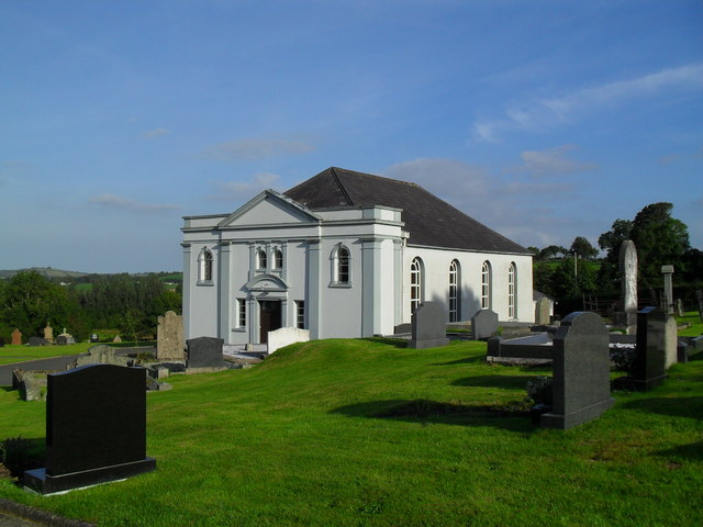
Image: © Dean Molyneaux Taken: 11 Sep 2009
Reputed to have been formed after discontentment with the minister of Annahilt Presbyterian in 1750. Sited on the Loughaghery Road in the townland of Cargygray, the congregation takes its name from a nearby lough, on which shores the first meeting house is thought to have been sited.
Images are licensed for reuse under creativecommons.org/licenses/by-sa/2.0
Image Location
Latitude
54.428062
Longitude
-5.995175