World's End: The End of the World
Introduction
The photograph on this page of World's End: The End of the World by Nigel Cox as part of the Geograph project.
The Geograph project started in 2005 with the aim of publishing, organising and preserving representative images for every square kilometre of Great Britain, Ireland and the Isle of Man.

There are currently over 7.5m images from over 14,400 individuals and you can help contribute to the project by visiting https://www.geograph.org.uk
World's End: The End of the World
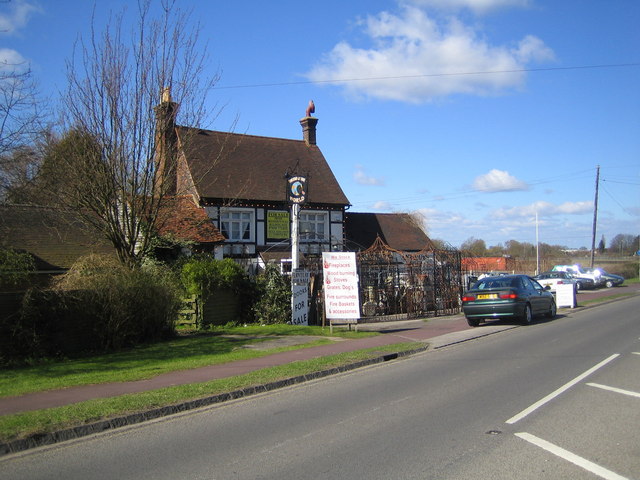
Image: © Nigel Cox Taken: 8 Apr 2006
World's End is a hamlet to the west of Wendover, and this is the former pub called "The End of the World" now in use as an antiques dealership. Alas the name of the pub is not ancient as the 1884 Ordnance Survey map rather more prosaically shows it as "The Swan". The road in front is the B4009 Wendover Road.
Images are licensed for reuse under creativecommons.org/licenses/by-sa/2.0
Image Location


Leaflet Map data © OpenStreetMap
Latitude
51.774904
Longitude
-0.757836