Trinity Church School - Rotherhithe Street, SE16
Introduction
The photograph on this page of Trinity Church School - Rotherhithe Street, SE16 by Chris Lordan as part of the Geograph project.
The Geograph project started in 2005 with the aim of publishing, organising and preserving representative images for every square kilometre of Great Britain, Ireland and the Isle of Man.

There are currently over 7.5m images from over 14,400 individuals and you can help contribute to the project by visiting https://www.geograph.org.uk
Trinity Church School - Rotherhithe Street, SE16
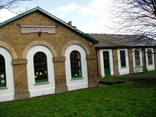
Image: © Chris Lordan Taken: 21 Jun 2005
Situated at the junction with Bryan Road, built in 1836 being arranged by the Rev Edward Blick - rector of St Mary's from 1835 until his death on 25-06-1867. The school closed in 1910 with the opening of Redriff Road school some 500 yards east in Rotherhithe Street. One wall bears the mark of the 1928 flood and is 3'-2" from ground level. Main floods of the area were in 1881, 1904, 1928 and 1953 - the 'main' meaning that boats had to be used to get essentials to marooned families. Currently contains a toddlers' group and a security firm. See second image http://www.geograph.org.uk/photo/1483023
Images are licensed for reuse under creativecommons.org/licenses/by-sa/2.0
Image Location
Latitude
51.497967
Longitude
-0.034953