The Hoddesdon & Broxbourne Conservative Club
Introduction
The photograph on this page of The Hoddesdon & Broxbourne Conservative Club by Robert Edwards as part of the Geograph project.
The Geograph project started in 2005 with the aim of publishing, organising and preserving representative images for every square kilometre of Great Britain, Ireland and the Isle of Man.

There are currently over 7.5m images from over 14,400 individuals and you can help contribute to the project by visiting https://www.geograph.org.uk
The Hoddesdon & Broxbourne Conservative Club
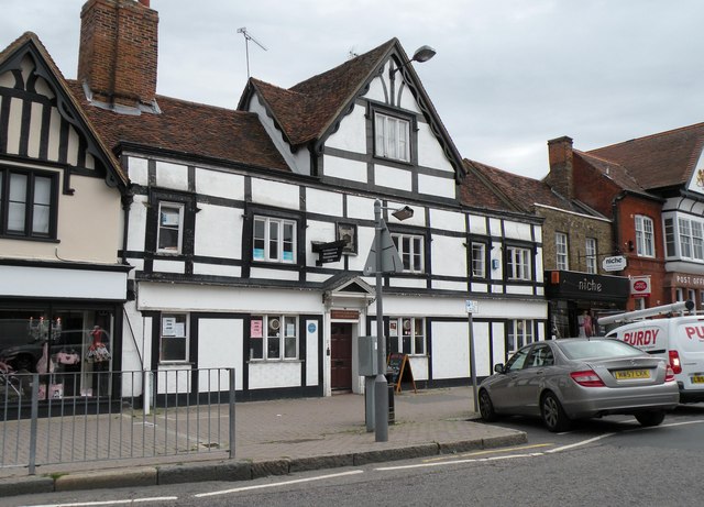
Image: © Robert Edwards Taken: 9 Sep 2009
This grade II listed building dates back to 1635 when it was known as 'The Stanboroughs'. The club has used this building since 1900.
Images are licensed for reuse under creativecommons.org/licenses/by-sa/2.0
Image Location
Latitude
51.759707
Longitude
-0.011727