1071 High Road
Introduction
The photograph on this page of 1071 High Road by Martin Addison as part of the Geograph project.
The Geograph project started in 2005 with the aim of publishing, organising and preserving representative images for every square kilometre of Great Britain, Ireland and the Isle of Man.

There are currently over 7.5m images from over 14,400 individuals and you can help contribute to the project by visiting https://www.geograph.org.uk
1071 High Road
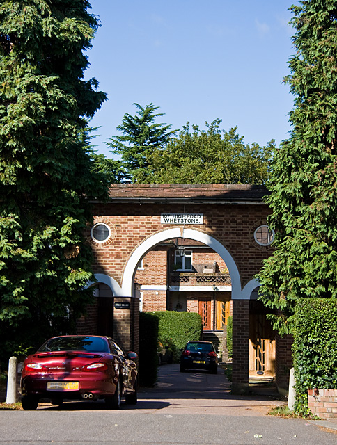
Image: © Martin Addison Taken: 5 Sep 2009
Evidence that we are in Whetstone. An unusual housing development, breaking from the terraced and semi-detached norm of the area. Apartments are arranged around 3 sides of a courtyard with trees on the 4th and parking in the centre.
Images are licensed for reuse under creativecommons.org/licenses/by-sa/2.0
Image Location
Latitude
51.625423
Longitude
-0.176239