Ballards Lane
Introduction
The photograph on this page of Ballards Lane by Martin Addison as part of the Geograph project.
The Geograph project started in 2005 with the aim of publishing, organising and preserving representative images for every square kilometre of Great Britain, Ireland and the Isle of Man.

There are currently over 7.5m images from over 14,400 individuals and you can help contribute to the project by visiting https://www.geograph.org.uk
Ballards Lane
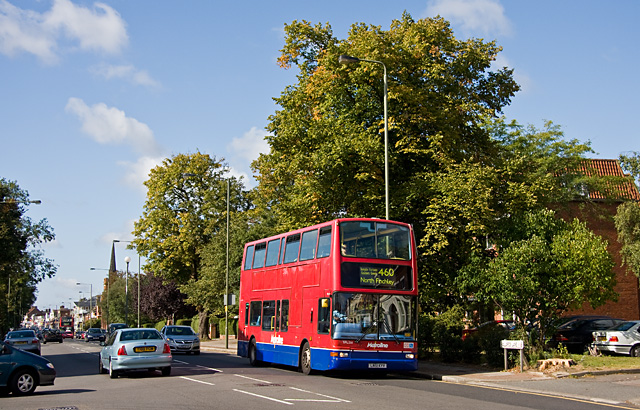
Image: © Martin Addison Taken: 5 Sep 2009
A view of the A598 at the junction with Granville Road (on the left). The spire of Finchley Methodist Church is visible in the distances along with the shops that form the north-eastern end of Church End. TPL461 can be seen on the 460 route, to North Finchley, nearing the end of its run from Willesden.
Images are licensed for reuse under creativecommons.org/licenses/by-sa/2.0
Image Location
Latitude
51.60857
Longitude
-0.183067