Grange Burn
Introduction
The photograph on this page of Grange Burn by Richard Webb as part of the Geograph project.
The Geograph project started in 2005 with the aim of publishing, organising and preserving representative images for every square kilometre of Great Britain, Ireland and the Isle of Man.

There are currently over 7.5m images from over 14,400 individuals and you can help contribute to the project by visiting https://www.geograph.org.uk
Grange Burn
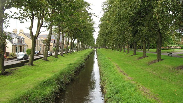
Image: © Richard Webb Taken: 4 Sep 2009
An obvious cause of flooding, the burn is canalised with embankments running its length. Much of its water no longer flows this way at all, being diverted through a deep channel into the Avon before it gets near Grangemouth.
Images are licensed for reuse under creativecommons.org/licenses/by-sa/2.0
Image Location
Latitude
56.014774
Longitude
-3.719673